UK Map Centre’s range of UK Postcode Maps provides more detail and better clarity for your money. We have used Ordnance Survey map bases and the latest Royal Mail Postcode data supplied by Geoplan, so your business decisions will be based on the most recent information available.
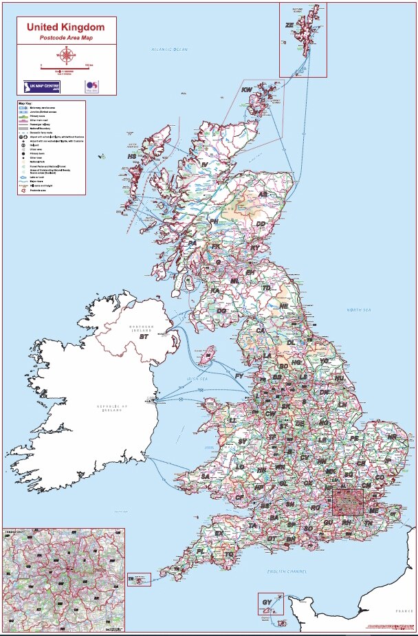
Postcode Area Maps
Series of maps covering the UK and illustrating the 124 postcode areas in the UK. Each map shows the Postcode Area Boundaries and has an Ordnance Survey mapping background which depicts the major transport links across the UK.
Postcode District Maps
Series of 8 postcode wall maps covering the UK. Each map shows the Postcode District Boundaries and has OS Road mapping which depicts the major transport links across the UK.
Postcode Sector Maps
Series of maps displaying postcode sector information within uk cities. Each map has a OS Vectormap District base with the postcode sector information added. The maps name main streets and road networks.
Postcode Street Maps
Series of postcode wall maps covering various city centres in the UK. The maps display OS Streetview mapping, which shows street names and transport links, combined with Postcode Sector detail (e.g. G4 0).
![]()